A Guide to Walk Leading for Hants 20&30s
Walk leading can be done by anyone; the aim of this guide is to give you confidence and advice.
Planning a walk
The first step is to choose a walk. There are lots of books and an increasing number of websites with suggested routes and descriptions for you to hand pick, or for more flexibility and endless possibilities just make up a route yourself. There are some websites which help you to do this (see Resources section at the end) or there’s the tried and tested old fashioned method of working out a route on an Ordnance Survey map.
Length
How long do you want your walk to be? Our group tends to average 2mph (3kph) including rest stops. Most walks vary between 5 and 15 miles (8 to 25km), though evening walks are usually only 3 or 4 miles (5 or 6km) so we can finish before sunset. Mid-winter walks tend to stay below 10miles (15km) for the same reason. Remember that if your walk is very hilly you will need to allow for extra time.
Transport
You need to ensure there is adequate parking at the start of the walk, as most people will drive even if it is accessible by public transport. A blue ‘P’ sign on Ordnance Survey maps marks the location of car parks, though these vary in size and suitability. Generally you will need space for around 20 cars. It is often possible to arrange to use car parks of community halls and other organisations for a small donation per car.
If you are planning a linear walk involving public transport it is often best to catch the bus/train at the start of the walk, rather than just missing it when you get back! Check timetables before you plan too far. On the subject of timetables, if you are doing a coastal walk it’s a good idea to look at the tide timetables for the day of your walk.
Submitting a walk to the programme
To put a walk on the programme you will need to log in using your registered emails and complete the online submission form, available at the submit walk page. It should only take around 10 minutes. Let the Walks Co-ordinator know if you have any problems. If you would like to limit numbers there is the facility to set up a pre-booking system. Once your walk has been approved you should check the website to ensure everything is correct.
For insurance reasons you must be a member of The Ramblers to lead a walk. It is your responsibility to update your personal data on the database to ensure your RA status is up to date, if you have any problems contact the Membership Secretary for help.
There has been a recent trend for people to put walks on the programme very close to the event. However, if possible it is better to submit your walk several weeks in advance – it makes the group look more active and allows people to plan their weekends!
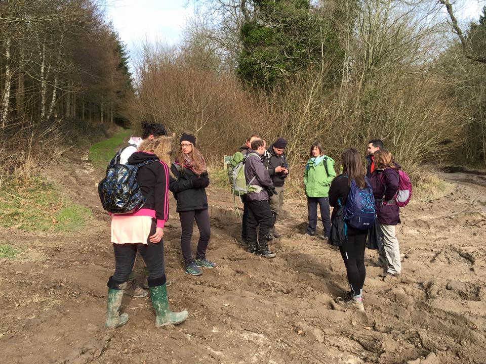
Reccying a walk
The reccy is important to ensure you can find your way around the route, and to check for potential hazards or problems such as busy roads, impassable paths, a weekend market in your chosen car park, etc.
Remember that path conditions can change quite markedly with the seasons. It is good practice to reccy your walk with a potential backmarker so they become familiar with the route, but this is not absolutely essential.
Some people do a reccy before they put a walk on the programme, just to be sure, but others do it closer to the walk date.
The reccy allows you to consider:
- How long the route takes (and how long it might take with a larger group, lots of stiles always slow a large group down!). Even with a straightforward route it’s likely that the group’s pace will be slower than your own.
- Places where the group should be careful such as road crossings.
- Whether people might need to be aware of issues like availability or cost of car parking, or muddy sections on route.
- The most suitable spot to stop for lunch. You ideally need somewhere along the route with enough space for a group of people to sit down without causing an obstruction.
- If the walk goes along the shoreline at any point then check the tide tables for that day.
- It’s a good idea to check the suitability and opening hours of any pubs or tea rooms you are planning to visit, and it’s also courteous to make sure that it will be ok to bring a largish group of people in on that particular day (particularly if you’re planning to eat packed lunches on/near their property).
- If you plan to use public transport then check timetables and cost (and any planned engineering works).
PLEASE NOTE: If you are unable to reccy the walk beforehand, please ensure you are familiar with the route and confident with leading a group along it.
If after the reccy you need to change the walk details on the website, you should log onto the database and click on the ‘edit’ option (the blue man) next to the listing on the ‘Events Planner’. You will need to wait for the Walks Co-ordinator to approve the changes before they appear on the website.
Map reading
This often worries people, but navigating paths and tracks in Hampshire is relatively easy, especially compared with more wild mountainous terrain, so it’s a great place to start learning. Ordnance Survey maps are usually very good, and your skills and confidence will develop with practice.
Scale
Any good map will have a scale. Ordnance Survey Explorer maps (the orange ones which are the most useful for leading walks locally), have a scale of 1:25,000. This means that 1cm on the map equals 25,000cm on the ground, which is 250 metres. This is useful to remember when considering the true distance between points on the map.
Visualisation
- If you’re not familiar with what the symbols on a map represent, spend time studying it before you do your reccy. What features will you pass en route?
- Public footpaths, bridleways, and byways, which you will probably use for most of your walk, are marked as dashed green lines.
- Take note of the contours. Contours indicate height and on a 1:25,000 map increase in intervals of 5 metres (c.16 feet). If the contours are close together (like on the South Downs) the slope will be steep; if they are spaced out then slopes are gentle.
- When walking it is useful to think ahead. For example, thinking ‘I need to turn right in three hundred metres’ means you will look out for the junction and are less likely to miss it
- It is easier if you orientate the map to the way you are facing. If you are heading north, keep the top of the map in front of you, but when heading south turn it upside down! This means you won’t get your left and right confused at junctions.
- Field boundaries, power lines, and buildings are all marked on OS Explorer maps and can be useful markers to locate your position, though field boundaries do occasionally change.
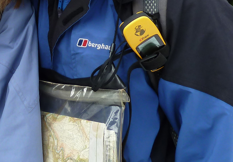
Compass
There should be little need for a compass in Hampshire as there are a lot of features to navigate by, but it may be useful if you are lost or not sure which path to take at a junction such in the New Forest where the terrain can look very similar. The compass needle always points north, so if you line the map up with the compass, such that the top of the map points north too, it will help you work out which way to go. There is little need to go into further depth for the purposes of this guide but you can find plenty of resources online.
Grid squares and grid references
Ordnance Survey maps are divided up into squares of 1km by 1 km (1 kilometre is about 0.6 miles, so 10km is about 6 miles), so a quick way to get a rough estimate of distance is to count how many grid squares you are crossing, though you need to take wiggles into account!
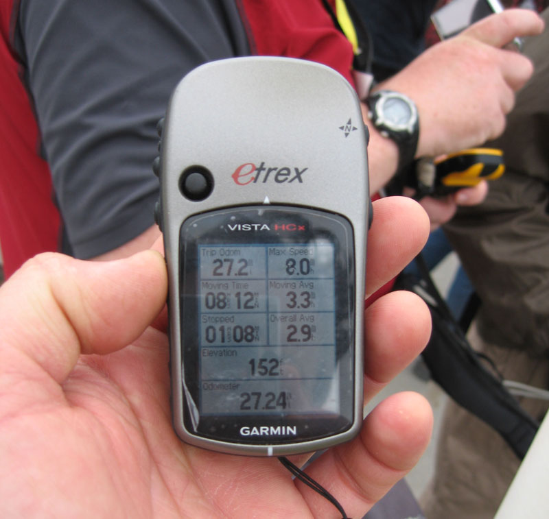
These grid lines have numbers, which are part of the National Grid Reference System. This numbering system means that any location in the country can be pinpointed by a unique grid reference. The walks submission form on the database allows you to pinpoint the starting point of your walk on an electronic map, so an understanding of grid references is less vital than it used to be. However, it is still useful to know what they are and how they work, especially in the unlikely event that you need to call out the emergency services.
The key on OS maps explains how grid references work, but the main points are:
- The country is split up into 100km by 100km squares, each of which is allocated a unique lettered code. The vast majority of Hampshire is SU.
- Go horizontally across the map first and take the number of the grid line on the left side of the grid square containing your chosen location. Then mentally divide the square into tenths and estimate how many tenths across the square your chosen location is (still working from the left). In the example below, the church is 3 tenths across, so the horizontal reference is 323.
- Then go vertically up the map and take the number of the grid line at the foot of the square, and again estimate the number of tenths up the square you need to go to get to your chosen location. In this case it’s 6 tenths, giving a vertical reference of 766.
- Merge the parts of the reference, with the horizontal part always coming before the vertical – in this case giving a grid reference of SU 323766
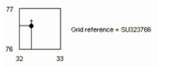
This might sound scary but becomes second nature once you’ve done it a few times!
The days before the walk
Recruiting a backmarker
You will need someone on the day to stay at the back of the walk and make sure no one gets left behind. The easiest way to find someone is to ask on a walk or social. Failing that you can use the Facebook page or send an e-mail to the group to ask for a volunteer.
Last minute checks
- Is there is anything people need to know which isn’t on the walks listing on the website? If so use the relevant forum on the group database to email it out.
- If you are using a train, check that it will be running on the day. On Sundays especially it is not uncommon for them to be replaced by buses, which may mean the times change.
- Keep an eye on the weather forecast. You must turn up whatever the weather, but if the forecast is bad you may wish to shorten the walk, or warn people if you feel it will be very exposed. In extreme cases conditions can become dangerous e.g. high winds, and you will need to decide whether it is safe for the walk to go ahead. If you cancel it then you must get to the start point to inform people.
- If you have to pull out of the walk at short notice and your backmarker is unable to lead it, do let the Committee know as a matter of urgency as they may be able to arrange for someone else to take over. Total cancellation should be a last resort and if it is unavoidable you should arrange for someone to get to the start point to inform anyone that turns up.
- Print off the Walk Leaders’ Pack from the database to get a tick-list of members. You can do this 7 days before your walk by clicking on the icon next to your listing on the ‘Events Planner’ page.
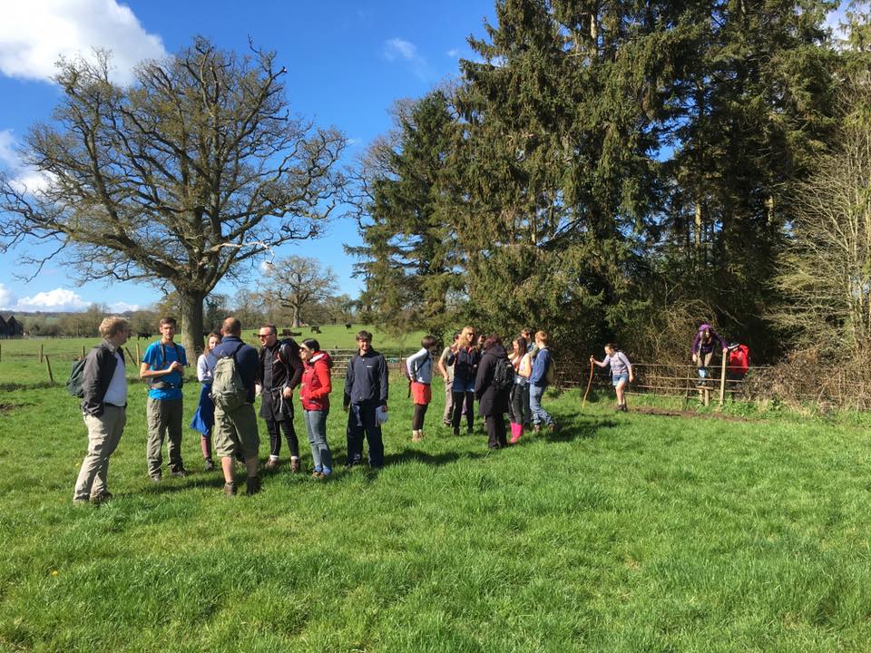
Walk day
At the start:
- Turn up in good time. If the walk starts at 10.30 you should aim to get there soon after 10:00 to welcome everyone.
- Introduce yourself to new members and people you haven’t met before.
- Ensure everyone is suitably equipped. People usually are, but if you think that someone is so ill equipped that they will struggle, for example no waterproof jacket on a wet day or high heeled shoes, you are within your rights to tell them. In extreme cases you can refuse to let them join the walk if you feel they will cause problems for themselves or the rest of the group, but in practice there is very rarely a need for this.
- Make sure everyone ticks off their name on the walkers list or adds it to the bottom.
- Inform new members of our policy of allowing them to trial three walks before joining the RA (can also be done during the walk).
- Start the walk on time. Before you set off give a short briefing. Inform people of the walk length, a brief route description and points of interest, if there will be any pub or tea room stops, and whether there are any sections you want dogs on leads. You also need to introduce your backmarker.
- Do a head count.
If people phone to say they are running late, use your discretion. Most people don’t mind waiting a few minutes, but if they are to be a lot longer it may be better to let them know which way you are heading so they can catch up. Leaving your backmarker to wait and accompany them until they catch up is also an option.
During the walk:
- DON’T GO TOO FAST! Many people inadvertently walk faster than they would ordinarily when leading a group of people. Be aware of this and make sure you keep to a steady pace, always keeping in mind those new walkers who might not be able to keep up the pace.
- Keep an eye on the people at the back of the group and stop to wait for them to catch up if they get too far behind. If a large proportion of the group keeps lagging way behind then you are probably going too fast.
- Have regular short breaks so people get the chance to have a drink and snack. Take this opportunity to do a head count and reassure yourself that you haven’t lost anyone.
- At junctions always ensure that people behind are within sight, so they don’t miss the turning.
- Be very careful when crossing or walking along busy roads. When people are walking and chatting they tend not to be very observant of traffic hazards. It’s safest to stop before a busy road and warn people before setting off again, ideally getting them in a compact group rather than strung out along the roadside. When crossing ensure there is sufficient space for people to gather on the other side and wait until everyone is safely across before continuing.
- If the group is moving much slower than expected, people are struggling, or the weather is bad, then you may consider cutting the walk short. Ultimately the safety and well being of the participants is the priority.
No need to stress, enjoy yourself!
At the end:
- Thank people for coming.
- Let people know if you are planning to go a pub or tea room and directions to find it if travelling there by car.
After the walk
- Enter the details of your attendees onto the database by clicking on the icon next to the walk listing on the ‘Events Planner’.
- Congratulate yourself and your backmarker on a job well done!
The Countryside Code
While out in the countryside, you and your companions should also follow the Countryside Code, which is basically common sense:
Respect other people
- Consider the local community and other people enjoying the outdoors
- Leave gates and property as you find them and follow paths unless wider access is available
Protect the natural environment
- Leave no trace of your visit and take your litter home
- Keep dogs under effective control
Enjoy the outdoors
- Plan ahead and be prepared
- Follow advice and local signs
Dogs on walks
We have a dedicated page with advice and gudiance to bringing on our walks here.
Path problems
The public right of way network in Hampshire is generally in a good state. However, you may still encounter issues such as paths being blocked by overgrown vegetation, a fallen tree or other obstruction, or broken stiles, signposts, gates etc. All path issues in Hampshire should be reported to Hampshire County Council via this link.
This will help to ensure that other walkers do not experience the same problems.
More resources
Ordnance Survey Maps online
This is a useful online tool which allows you to plot a route on a map, measure it’s length, and even export it to a GPS device, amongst other things. You need to pay a monthly subscription to access it, current prices here.
Ramblers Routes
The Ramblers Association are currently in the process of building their own database of walks, with each walk being checked by someone on the ground before it is published. It’s free to RA members but you need to register. Ramblers Routes
Other Resources
There are many online resources on map and compass work – here is an example.
In addition there are many people in the group who have led walks and will be happy to help if you have any questions or need any advice, and you can contact the Committee at any time.
You can download some extra guidance in PDF format courtesy of The Ramblers;